It may not seem like it, but this record-breakingly hot summer won’t last forever.
The 2024 Old Farmer’s Almanac predicts an unseasonably cold and stormy winter as El Niño — a climate phenomenon that often brings wetter, cooler weather to Texas — rolls in.
Don’t get too excited just yet. Until then, the almanac predicts September, October, and November will still be warmer and drier than usual. October, which is typically the second-stormiest month of the year for Austin, is forecast to have at least two fewer inches of rain than average.
How accurate is that prediction? The almanac has been recording and tracking weather patterns since 1792 (when George Washington was president), using a secret formula developed by the almanac’s first editor, Robert B. Thomas.
The Old Farmer’s Almanac claims to be accurate 80% of the time, but a 2010 University of Illinois study showed about 50% overall accuracy, so we’re getting a second opinion.
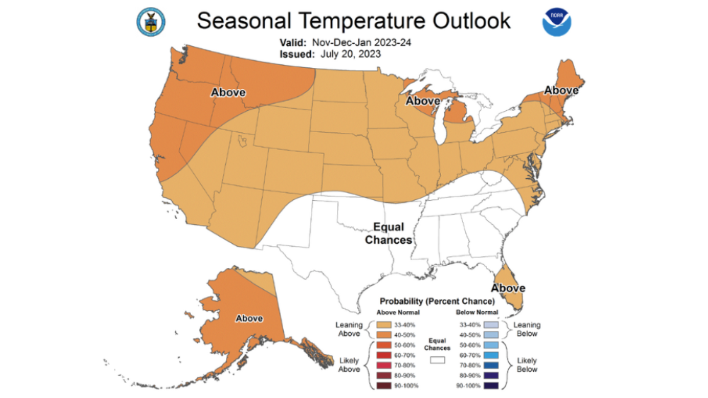
According to the National Weather Service, temperatures from November-January have equal chances of being above or below average. It’s likely that the upcoming winter will be stormier than average, as the NWS predicts 33-40% chances of above-average precipitation.
Don’t expect things to cool down until the end of October, as the NWS predicts a 50-60% chance of higher temperatures over the next 90 days.
Precipitation from now to October could go either way, as the NWS doesn’t have strong correlation for above or below-average storms.
Phew. All that is to say, don’t put away the sunscreen just yet, but brace for potentially chilly temperatures ahead.


